At the time of writing this, there were four polar orbiting weather satellites that orbit the earth on a sun-synchronous orbit and transmit realtime imagery that can be captured using cheap and readily available equipment such as the RTL-SDR blog v3 dongle and v-dipole kit. Each satellite gives you 2-3 good passes in the morning and another 2-3 passes in the evening. The three American satellites (NOAA-15, NOAA-18 and NOAA-19) were flying relics that transmitted analog signal using the automated picture transmission (APT) system with a resolution of approximately 4 km/pixel. At the time there was one Russian satellite (Meteor M2) that transmitted using the low rate picture transmission (LRPT) system with a resolutions of approximately 1.1 km/pixel. Neither the NOAAs nor the Meteor bird transmitted true color images. I understand nowdays there are only two Russian satellites in the orbit: Meteor M2-3 and Meteor M2-4 transmit using the LRPT system. The captures below are false color captures created by merging various visible and infrared channel images transmitted by the four satellites. There are literally hundreds of online guides and howtos on setting up a system and receiving images so I won't bother writing a new one.
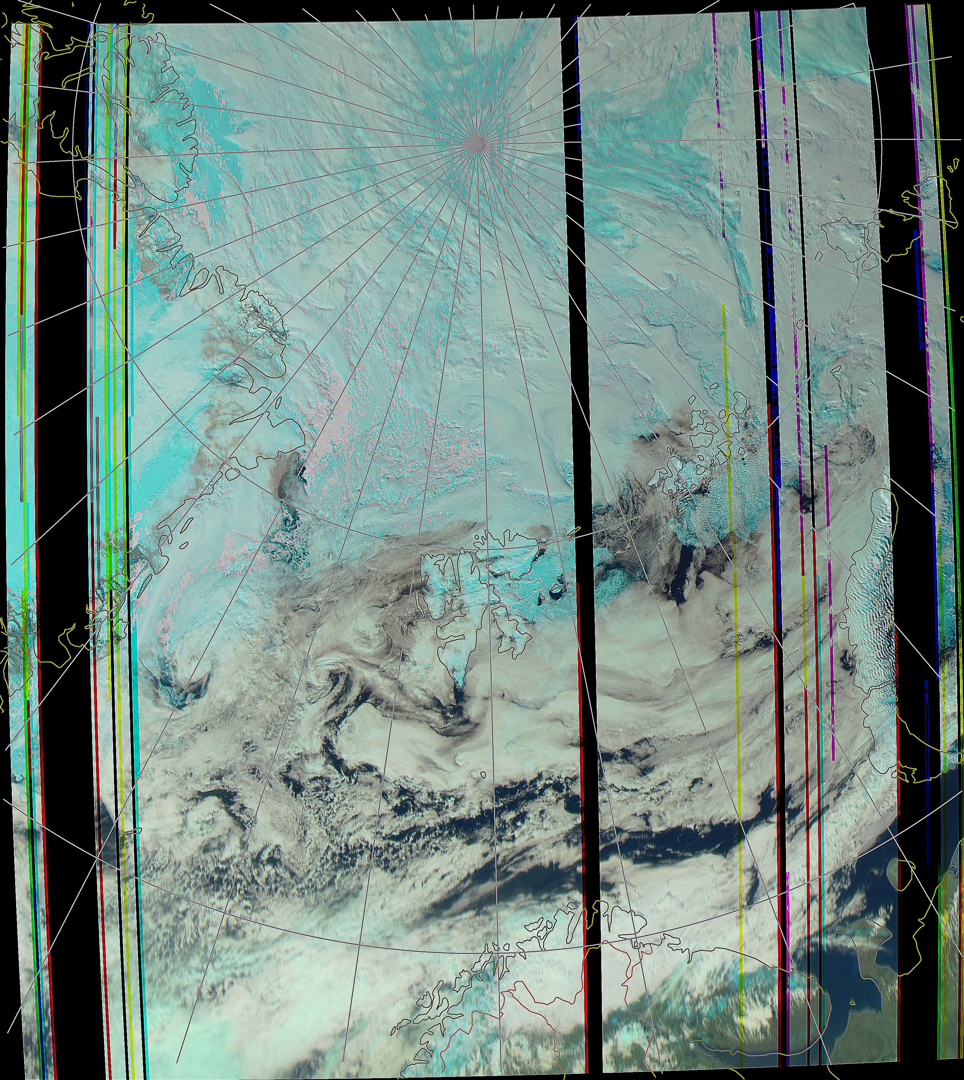
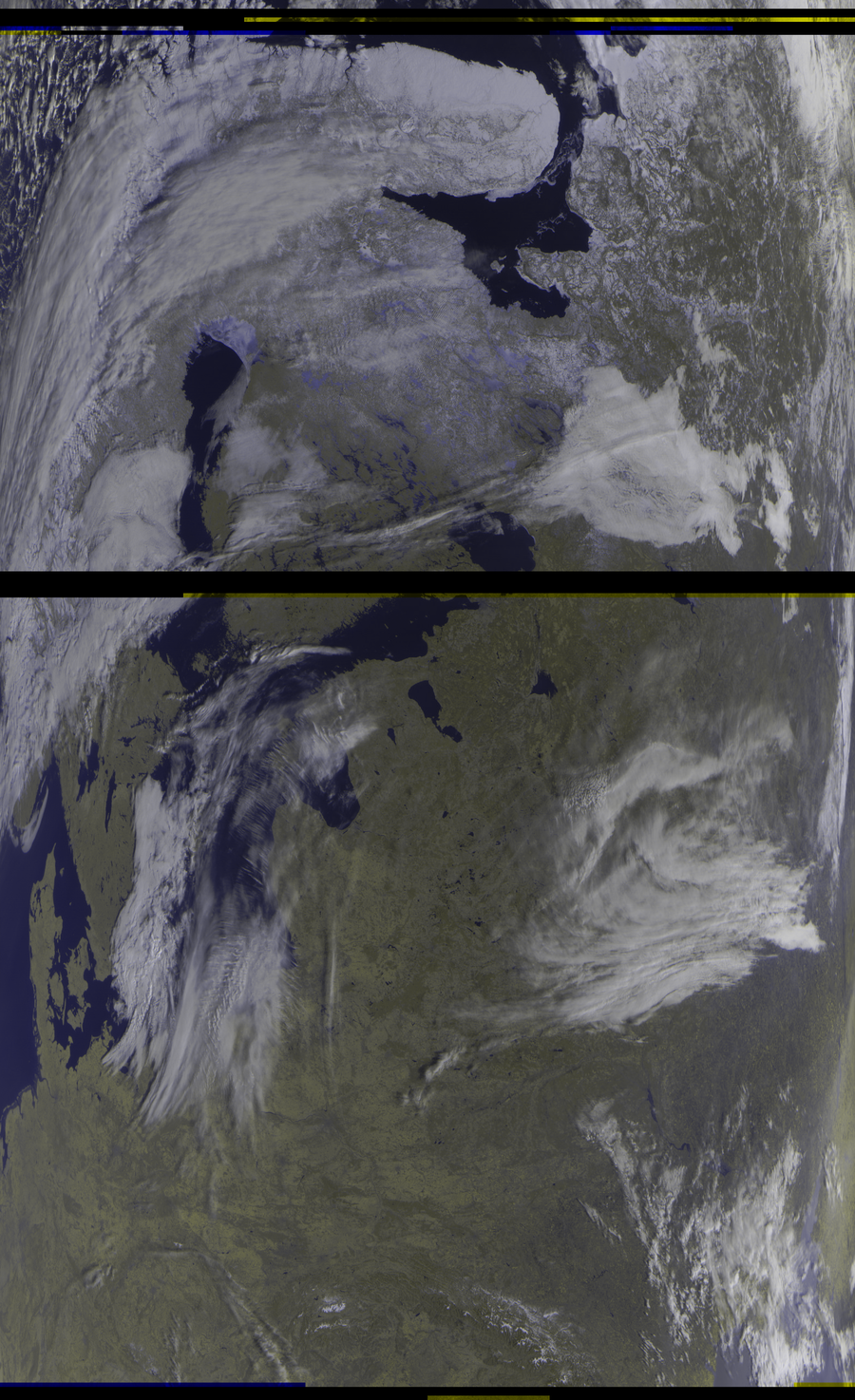
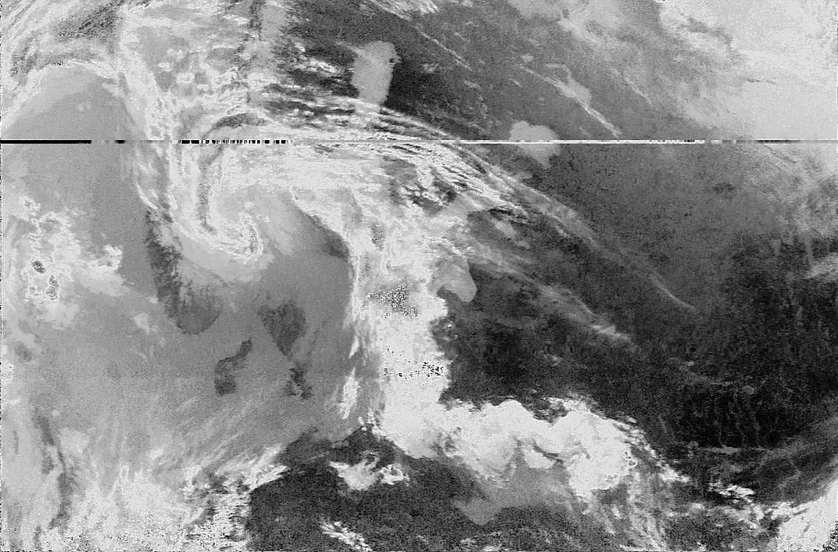
Meteor M2, 20200604, 1243 UTC, 8 degrees. Saw the North pole for the first time! Oulunkylä. 123 profile. Processed in MeteorGIS. Airspy mini+QFH.
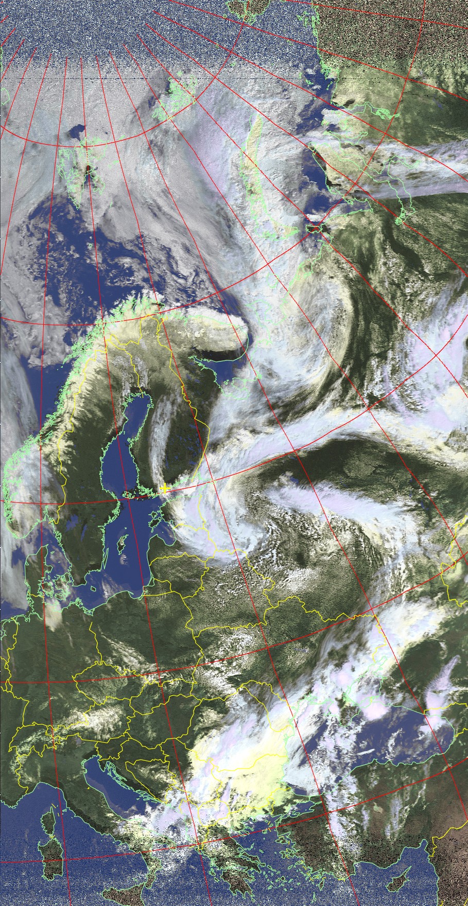
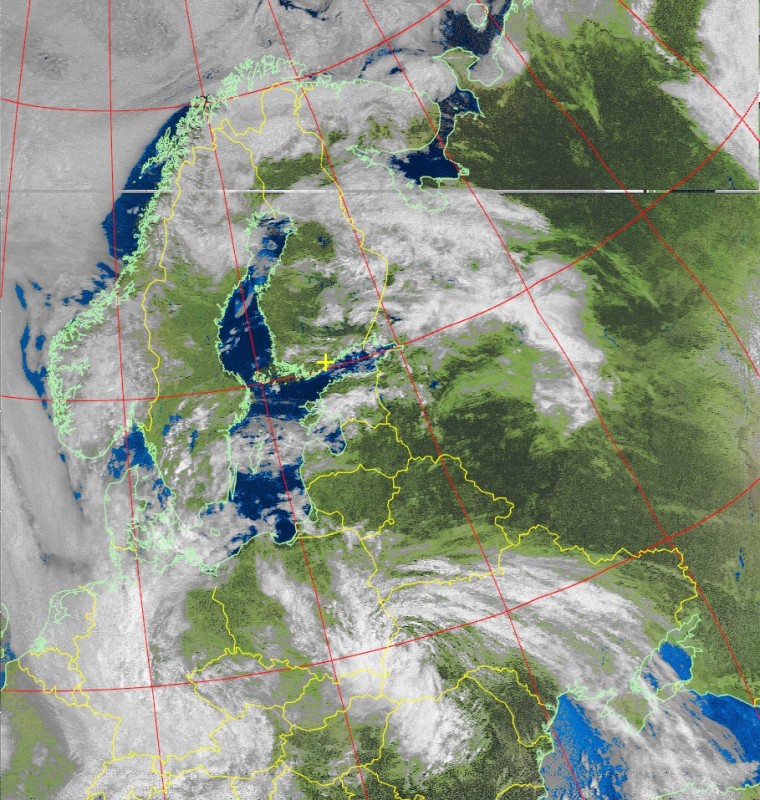
NOAA 18 ch 1-4, 20200521, 0801 UTC, southbound 60 E. HCTV false colour. Image received in Oulunkylä, Finland. New equipment and a year of practise later. Airspy Mini+QFH antenna.
Meteor M2, 2020412, 0647 UTC, southbound. Sometimes Meteor M2 losed its orientation. The imager is pointing towards the east instead directly down towards the earth. 125 profile. Scaled to 57%. RTL-SDR V3+v-dipole.
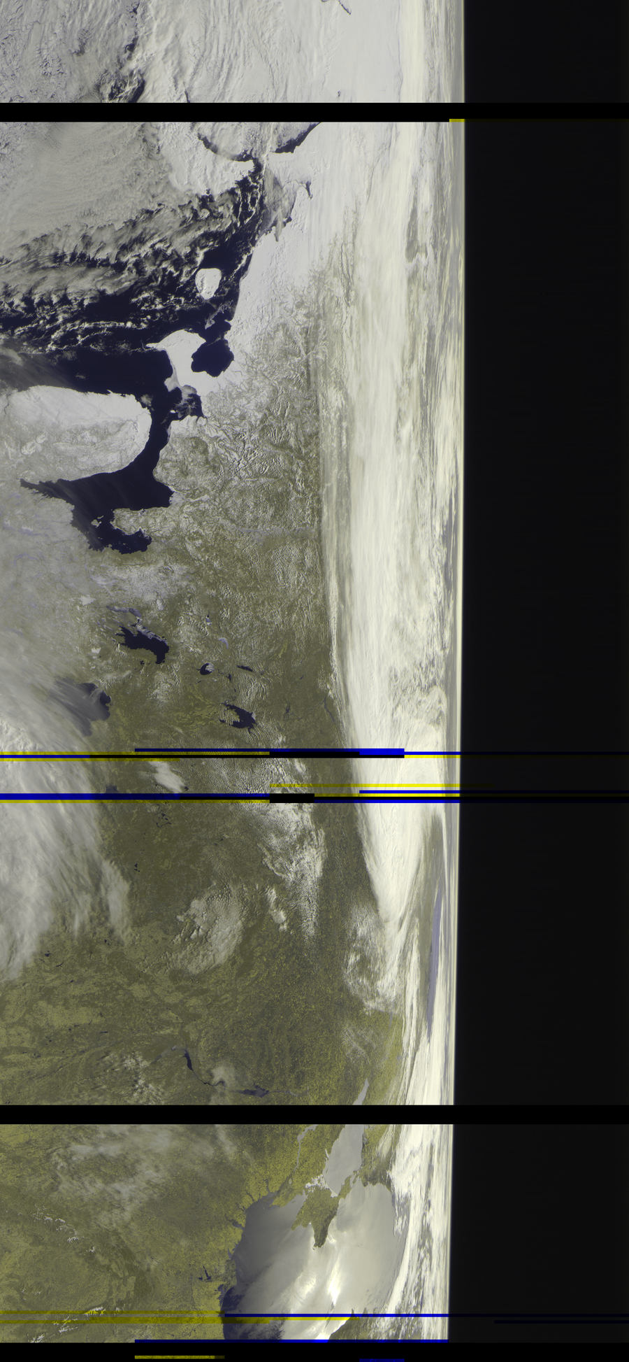
Meteor M2, 20200327, 0616 UTC, southbound 80ish E. NOAA is nice, but Meteor M2 is better. First capture of the 2020 season. Snow line and sea ice is stil clearly visible. Oulunkylä. 125 profile. Scaled to 57%. RTL-SDR V3+v-dipole.
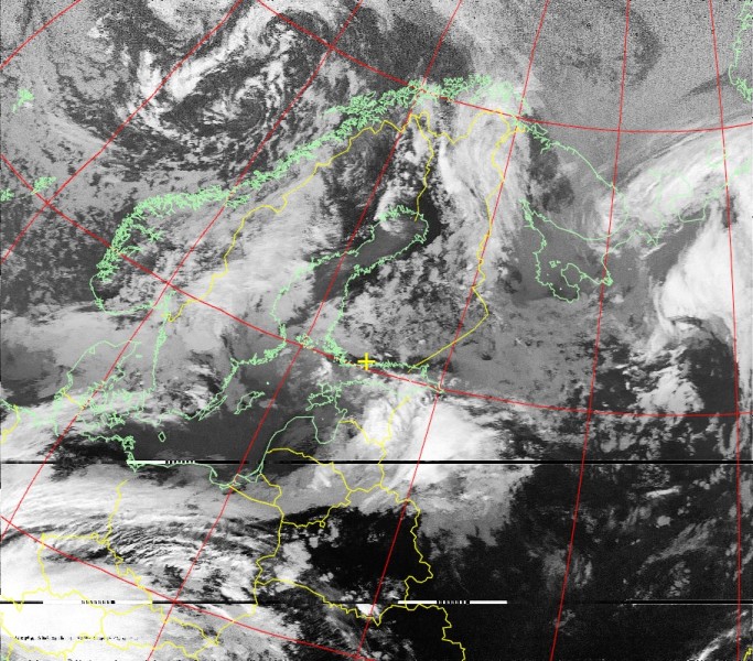
NOAA 15 ch 2-4, 20190527, 1608 UTC, northbound 87 E. Channel A, contrast enhanced. Cropped and scaled down. Nooelec SDR dongle equipped with a V-dipole antenna and LNA4ALL. Image received in the vicinity of the Pakila community garden in Helsinki, Finland. Some interference likely caused by high voltage power lines can be seen on the southern portion of the image.
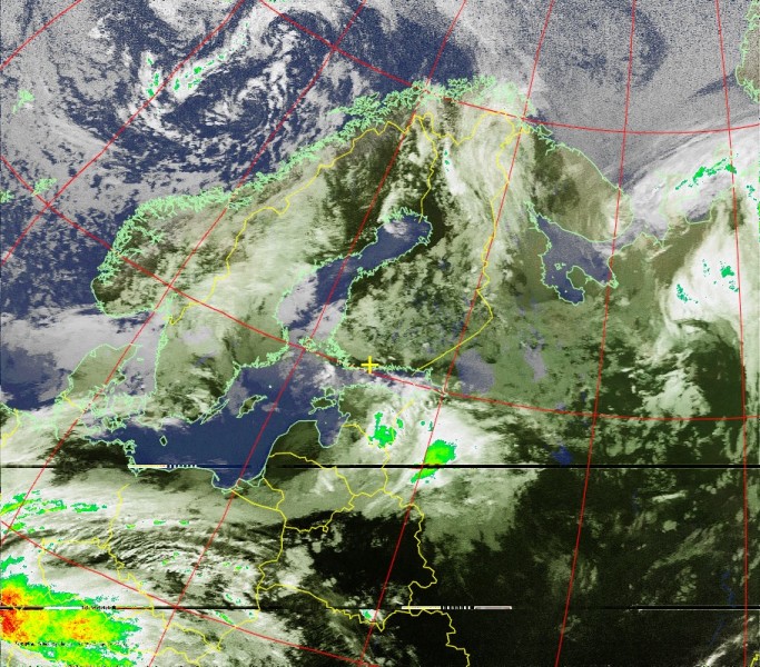
NOAA 15 ch 2-4, 20190527, 1608 UTC, northbound 87 E. MCIR with precipitation. Cropped and scaled down. Nooelec SDR dongle equipped with a V-dipole antenna and LNA4ALL. Image received in the vicinity of the Pakila community garden in Helsinki, Finland. Some interference likely caused by high voltage power lines can be seen on the southern portion of the image.
NOAA 18 ch 1-4, 20190521, 0738 UTC, southbound 74 E. MSA multispectral analysis. Cropped and scaled down. Nooelec SDR dongle equipped with a V-dipole antenna. Image received at Taivaskallio in Helsinki, Finland.
NOAA 18, 20190519, 0806 UTC, southbound 83 W. Channel B, contrast enhanced. Cropped and scaled down. Nooelec SDR dongle equipped with a V-dipole antenna. The first image I was able to receive. Volume was too low therefore quality is relatively bad. Image received in Oulunkylä in Helsinki, Finland.